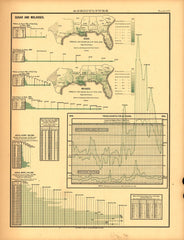
Vintage Visualizations
Prints & posters of old maps, historic data viz and infographics from ages long past
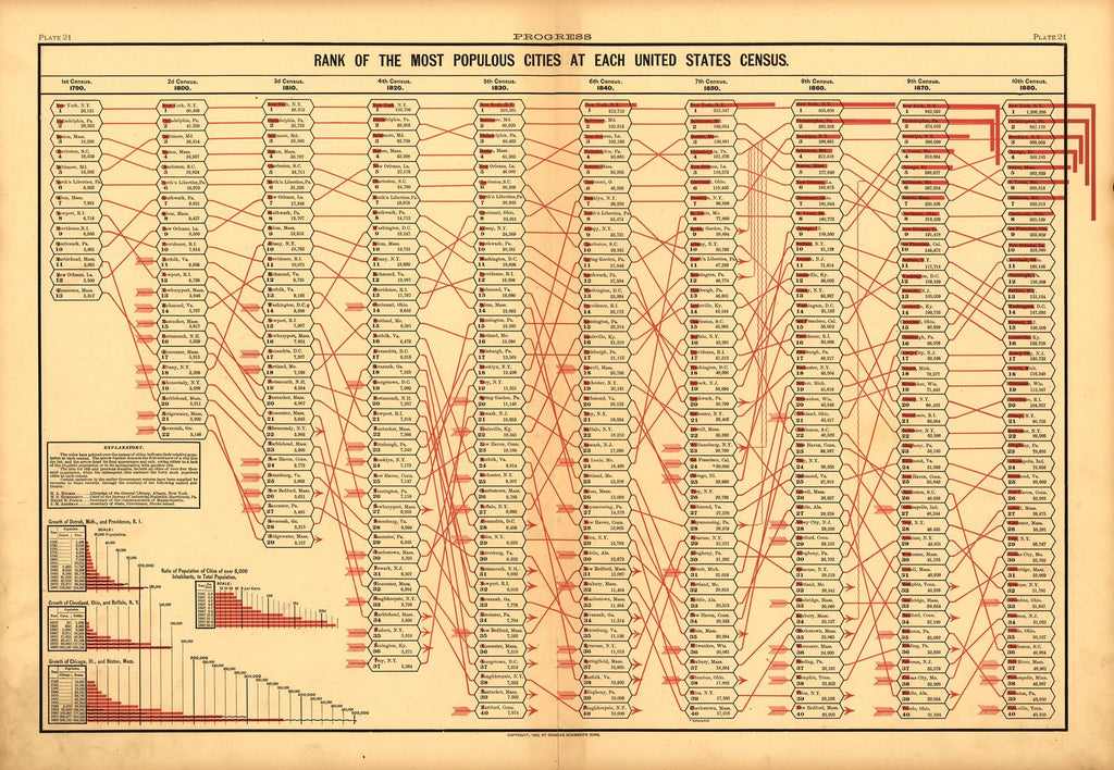
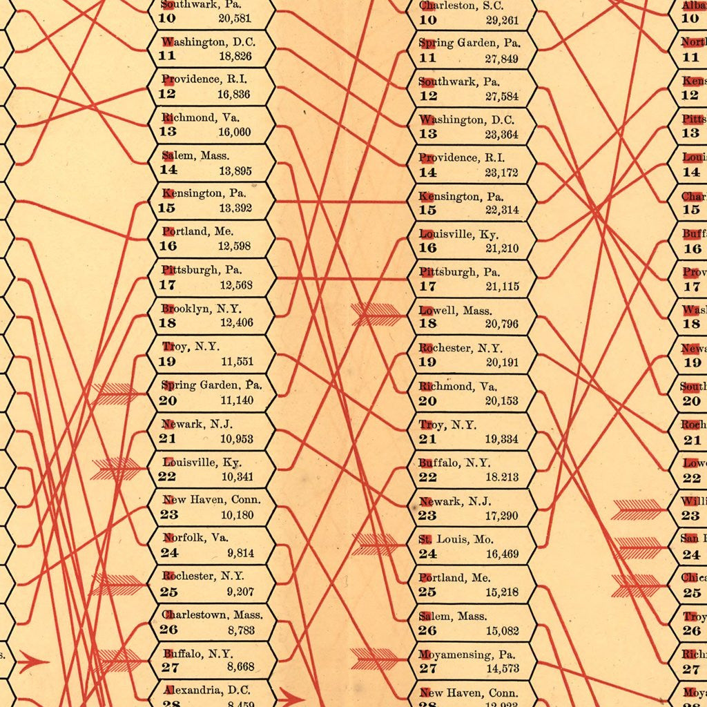
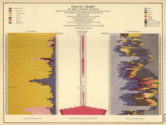
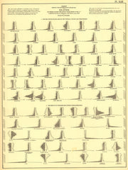
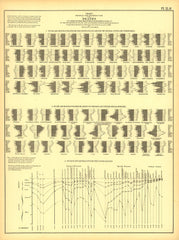
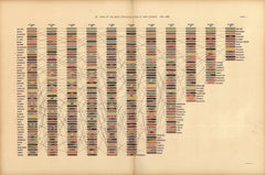
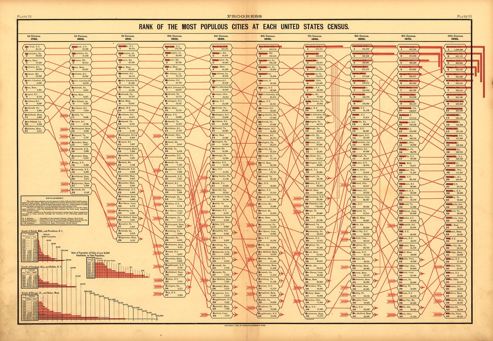
Progress (Rank of Cities by Population)
From Statistical Atlas of the United States (1880)
This illustration of the rank of cities by population at each U.S. census 1790-1880̴Ì_looks like a flow chart gone wild. Stylish arrow-feathers mark each city's entrance onto the list, and arrow-heads, each̴Ì_exit. And certain populations, like New York's, remind us where the phrase̴Ì_"off the charts" came from.̴Ì_This is a̴Ì_one-of-a-kind, dynamic,̴Ì_chaotic collection of information.
Tags: Census Atlas, charts, color, colorful, horizontal, interesting and unique, multicolor, orange, politics, Population
All prints are on matte, archival, acid-free paper, and all framed prints are framed in satin black wooden frames.
We've done a little bit of cleanup to prepare the image for printing, but this is a faithful reproduction of the source material, and bears any scratches, smudges, or tears that were in the original. How charming!
Attribution: Library of Congress, Geography and Map Division →


