Vintage Visualizations
Prints & posters of old maps, historic data viz and infographics from ages long past
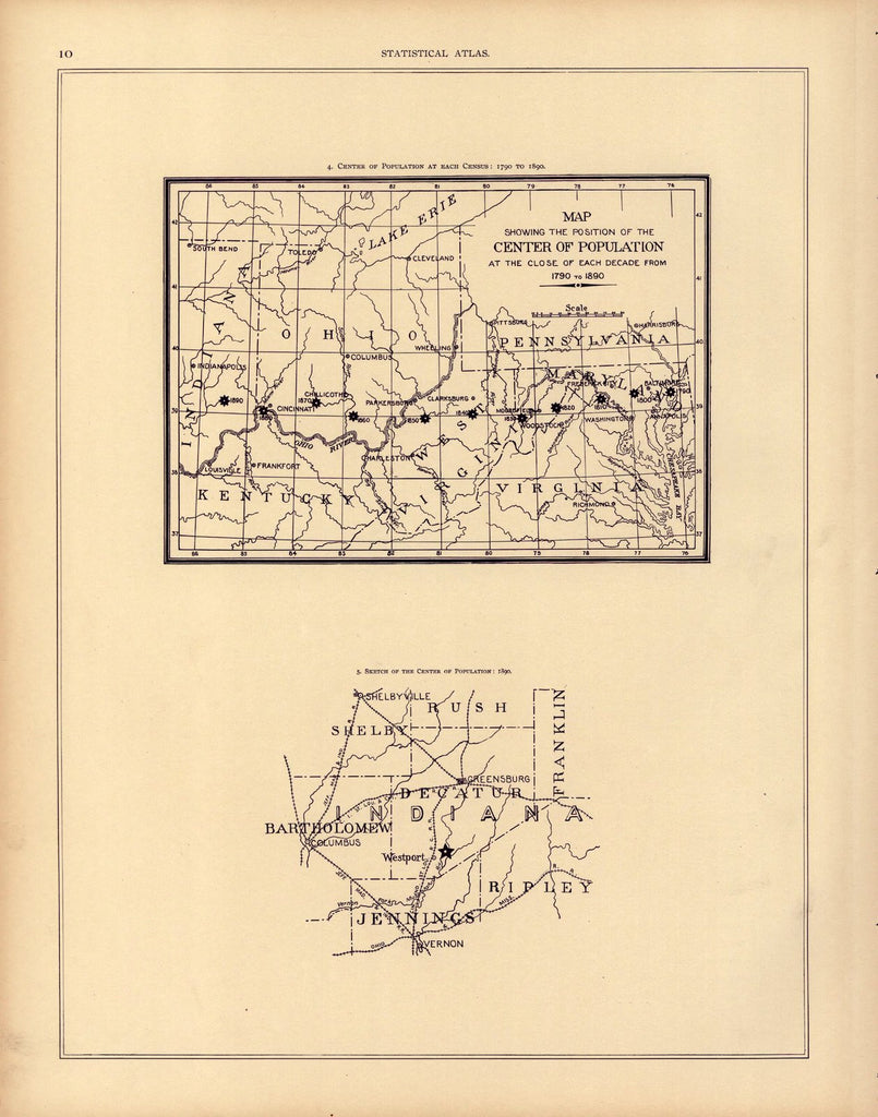
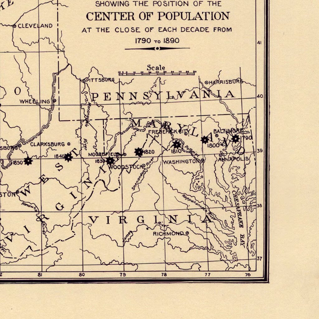
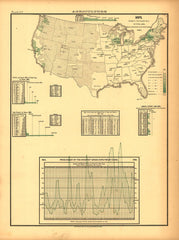
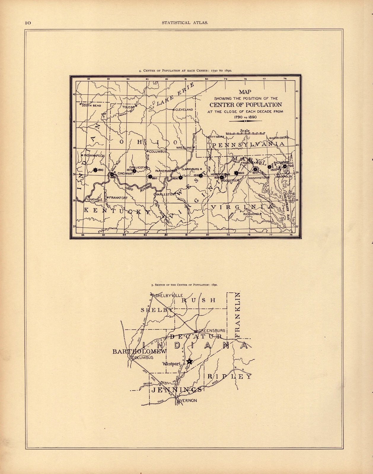
Center of American population at each Census: 1790 - 1890
From Statistical Atlas of the United States (1890)
This is a simple map, but it's one of our favorites and really captures the westward expansion that characterized 19th century America. As the center of the population moves from Maryland to Indiana, you'll get a sense of how the country grew at such a fast clip.
Tags: Census Atlas, charts, monochrome, politics, Population, vertical
All prints are on matte, archival, acid-free paper, and all framed prints are framed in satin black wooden frames.
We've done a little bit of cleanup to prepare the image for printing, but this is a faithful reproduction of the source material, and bears any scratches, smudges, or tears that were in the original. How charming!
Attribution: Library of Congress, Geography and Map Division →