Vintage Visualizations
Prints & posters of old maps, historic data viz and infographics from ages long past

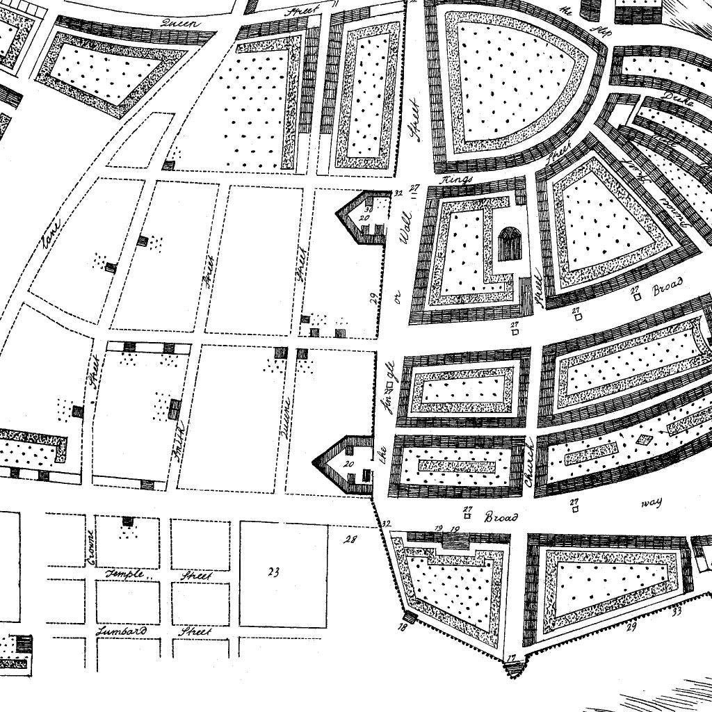
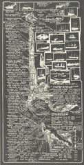
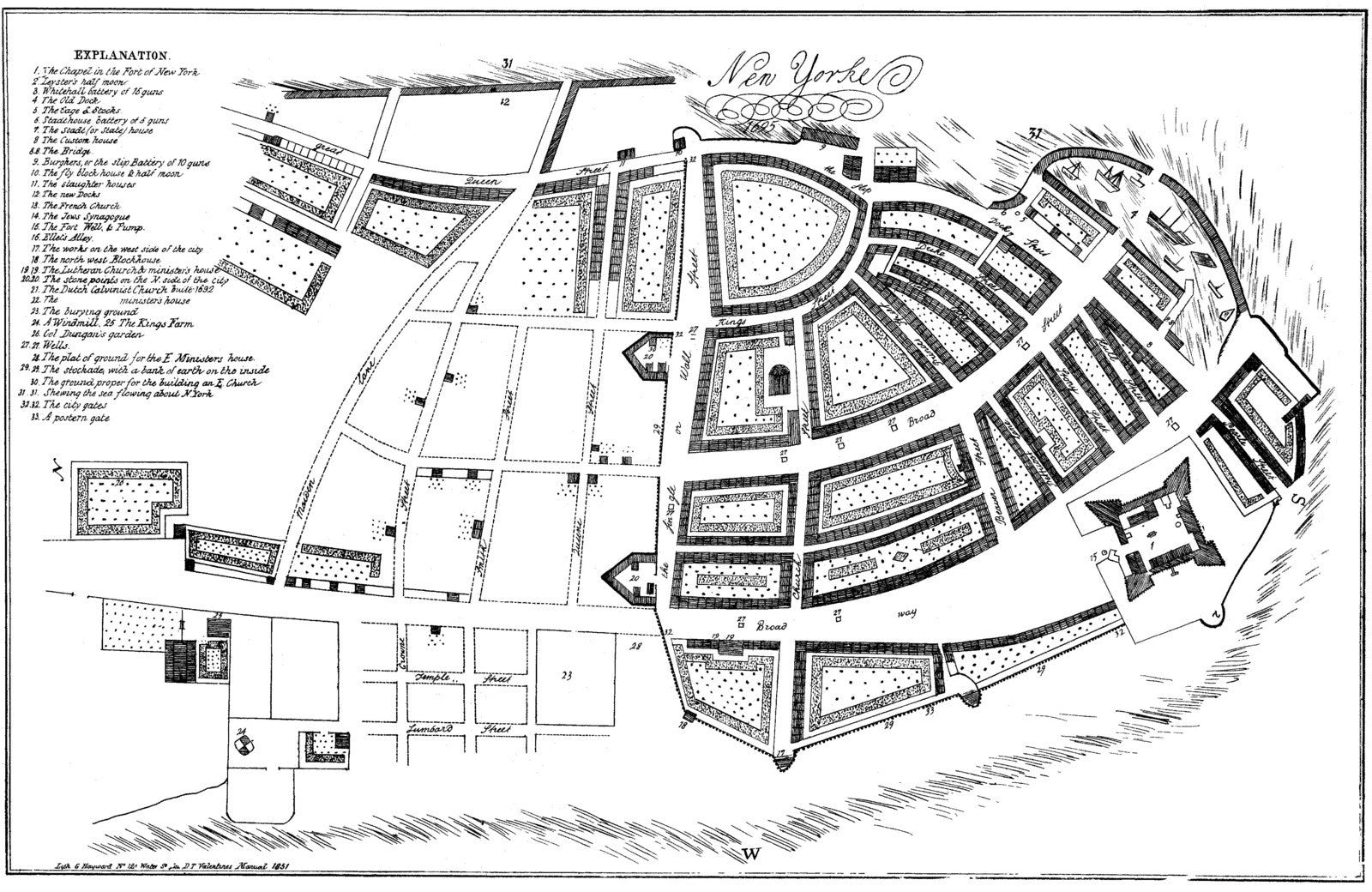
New York City - 1695
From Unknown, NOAA Historical Map Collection (1695)
This 17th century plan of New York illustrates that Wall Street really once had a wall! ItåÊwas built to protect the New Amsterdam settlement, whose northern border it ran along. This print also includes great details like a garden, a windmill, and sailboats.
Tags: 1690s, 1695, City Plan, front page, manhattan, maps, New York, NOAA
All prints are on matte, archival, acid-free paper, and all framed prints are framed in satin black wooden frames.
We've done a little bit of cleanup to prepare the image for printing, but this is a faithful reproduction of the source material, and bears any scratches, smudges, or tears that were in the original. How charming!
Attribution: NOAA Office of Coast Survey Historical Map & Chart Collection →