Vintage Visualizations
Prints & posters of old maps, historic data viz and infographics from ages long past
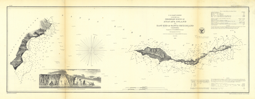

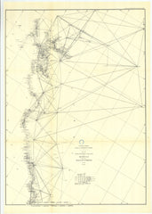
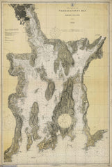
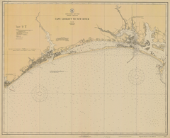
Preliminary Survey Of Anacapa Island And East End Of Santa Cruz Island, California
From U.S. Coast Survey, NOAA Historical Map Collection (1856)
Tags: 1850s, 1856, Annual Report, California, channel islands, los angeles, malibu, maps, NOAA, oxnard, santa barbara, santa cruz, santa monica
All prints are on matte, archival, acid-free paper, and all framed prints are framed in satin black wooden frames.
We've done a little bit of cleanup to prepare the image for printing, but this is a faithful reproduction of the source material, and bears any scratches, smudges, or tears that were in the original. How charming!
Attribution: NOAA Office of Coast Survey Historical Map & Chart Collection →