Vintage Visualizations
Prints & posters of old maps, historic data viz and infographics from ages long past
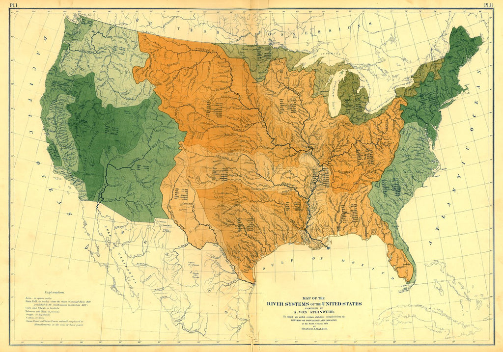
River systems of the U.S.
From Statistical Atlas of the United States (1870)
Water: always relevant! This map of U.S. river systems provides a watershed-based alternative to our usual state-line divisions. It also includes natural resource information--including sugar measured in hogsheads!
Tags: Census Atlas, color, colorful, front page, geography, horizontal, maps, multicolor, single map
All prints are on matte, archival, acid-free paper, and all framed prints are framed in satin black wooden frames.
We've done a little bit of cleanup to prepare the image for printing, but this is a faithful reproduction of the source material, and bears any scratches, smudges, or tears that were in the original. How charming!
Attribution: Library of Congress, Geography and Map Division →
