Vintage Visualizations
Prints & posters of old maps, historic data viz and infographics from ages long past

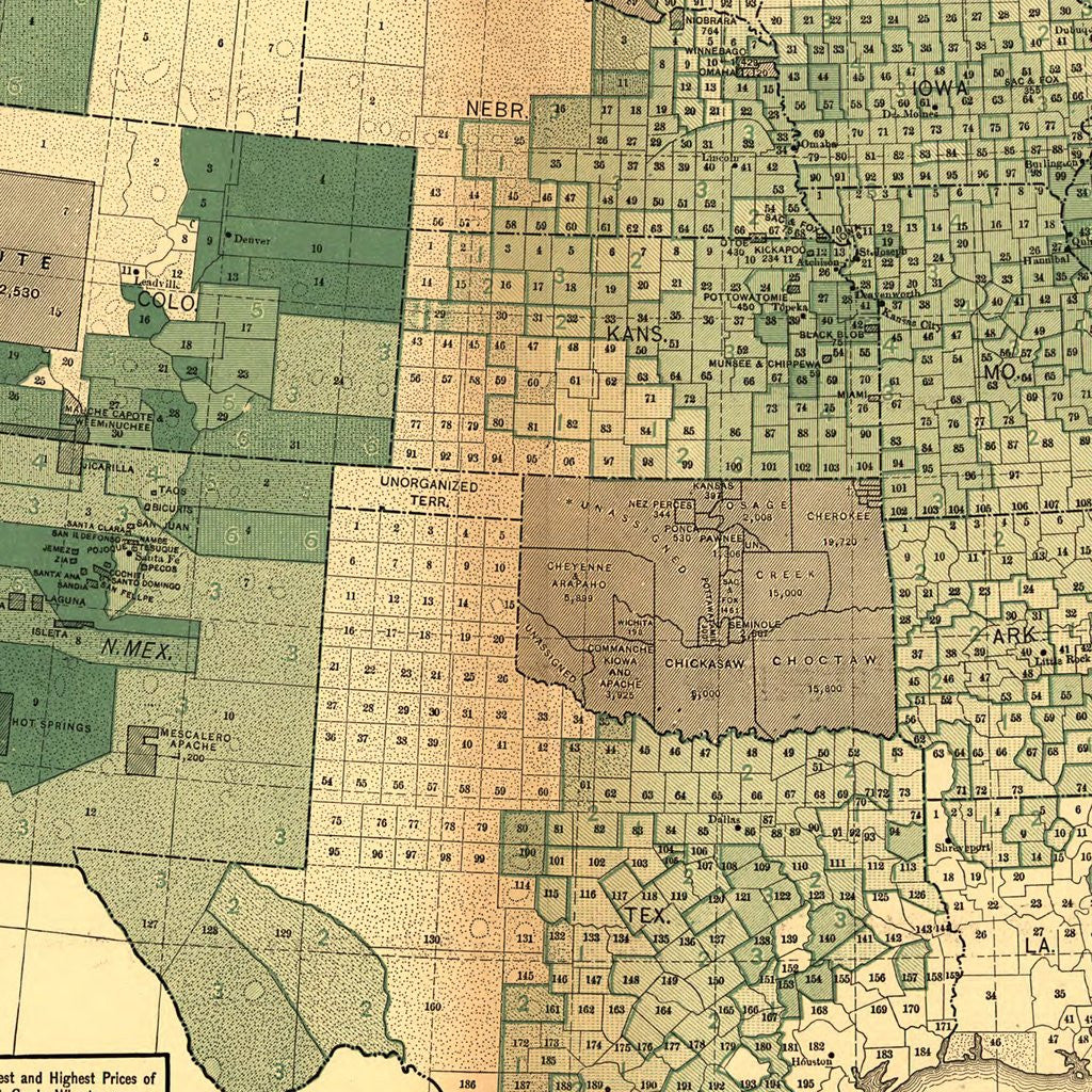
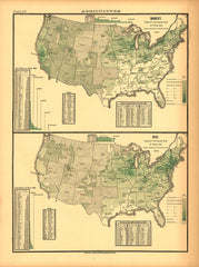
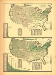
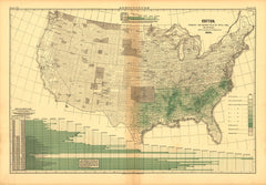
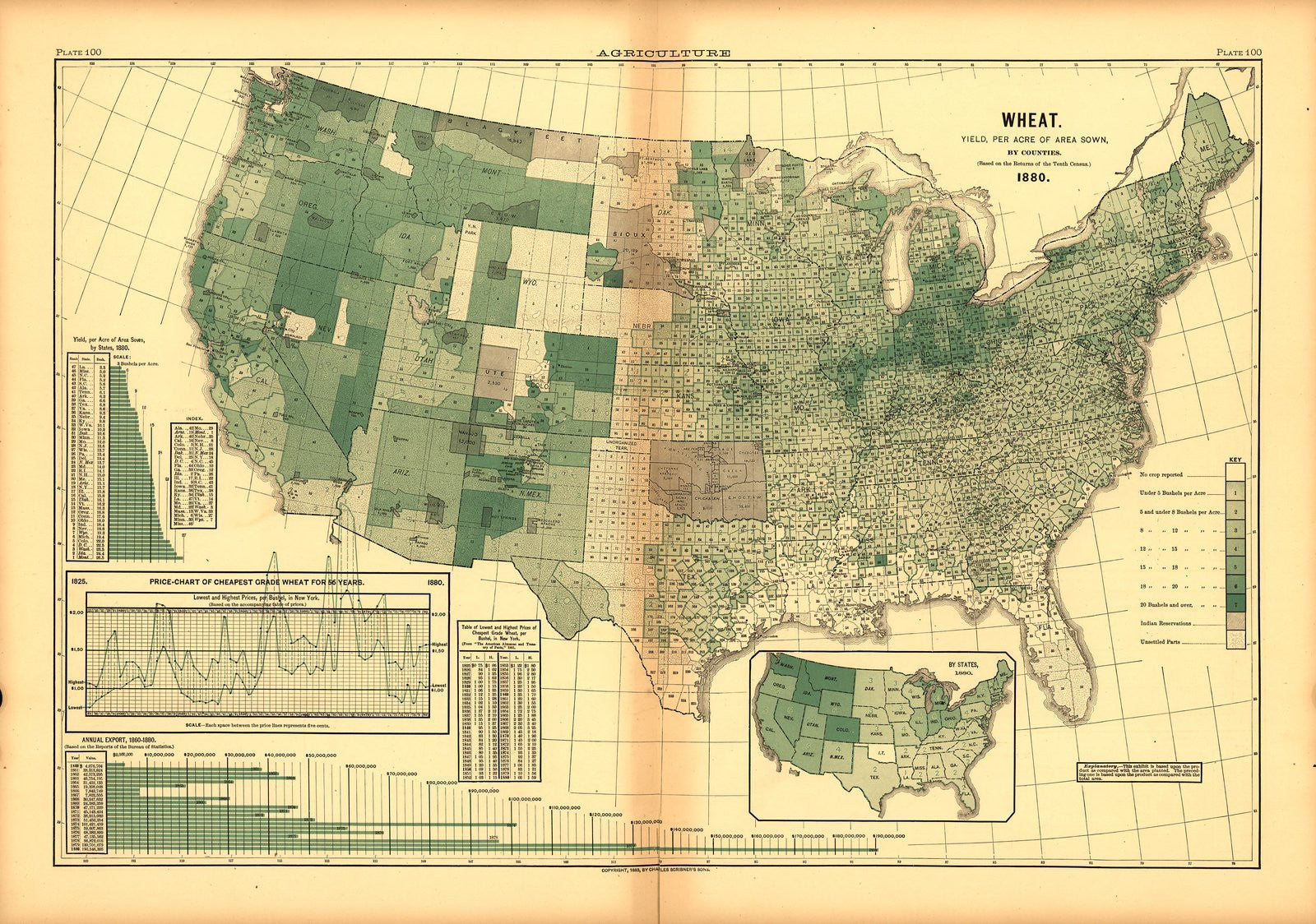
Agricultural Production (Wheat per acre)
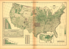
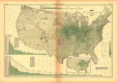
From Statistical Atlas of the United States (1880)
Which state yielded the most wheat per acre sown in 1880's America? The answer might surprise you: Montana.
Tags: agriculture, Census Atlas, color, green, horizontal, maps, single map
All prints are on matte, archival, acid-free paper, and all framed prints are framed in satin black wooden frames.
We've done a little bit of cleanup to prepare the image for printing, but this is a faithful reproduction of the source material, and bears any scratches, smudges, or tears that were in the original. How charming!
Attribution: Library of Congress, Geography and Map Division →


